Wine Australia National Scan for Vineyards

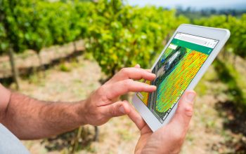
We used Machine Learning and high resolution satellite imagery to identify all vineyards on the Australian continent.

Challenge

In collaboration with Wine Australia, the National Vineyard Scan provides accurate and up-to-date data on Australia's grapevine plantings by conducting a comprehensive survey of the country's vineyards. This data can assist industry stakeholders, such as wine grape growers, winemakers, and policymakers, in making informed decisions regarding production, investment, and marketing. By gaining a detailed understanding of the size, composition, and geographical distribution of Australia's vineyards, project helps to identify emerging trends and issues in the wine industry.

The National Vineyard Scan project seeks a cost-effective and repeatable solution to address the significant challenges of surveying all 65 of Australia's wine regions.

The Australian Bureau of Statistics (ABS) used to gather basic vineyard data through the Vineyard Census, but the last census was conducted in 2015 and is no longer feasible. Any survey or reporting method that is not mandatory is likely to be inefficient and inaccurate. Wine Australia's strategic plan for improving resource management and sustainability cannot be achieved without accurate and up-to-date vineyard data.

Approach

To address the challenges of the National Vineyard Scan project, Consilium Technology developed an AI/ML model capable of detecting vegetation boundaries. The model uses algorithms to analyse satellite imagery and identify patterns that indicate the presence of grapevines, allowing for the identification of vineyards.

Green Brain Web Application provides an online map interface that allows users to access and visualise the locations and statistics of vineyard blocks across Australia for the benefit of Australian grape growers and wine producers. Green Brain Web Application provides value for the Australian wine sector by provisioning access to the results of the national scan, which is paid for using their levies.

Outcome

National Scan provided repeatable process over multiple years 2018-2022 with reliable identification of changes over each year and successfully detecting replanting. Solution is also used to identify the impact of bushfires and support vineyard management activities as well as biosecurity (phylloxera).

Case Studies

We have a strong reputation for taking on complex challenges. Find out more about the ground breaking work and projects we’ve undertaken.

  • All
  • Defence
  • General
  • News
  • Press Releases
  • Enterprise
'}}
Aurizn Group continues fast expansion with the acquisition of PAC Australia.
This strategic move strengthens Aurizn’s position as a Tier 2 defence technology business, enhancing its capabilities in cybersecurity, systems integration, and mission planning, among other areas. PAC Australia’s expertise will complement Aurizn’s existing strengths, enabling the combined entity to deliver comprehensive solutions to meet the growing demand for sovereign capability.
'}}
Leading Australian defence technology provider Aurizn Group sets the stage for global expansion with acquisition of McR Defence and new leadership
Following the strategic acquisition of McR Defence from the national independent law firm, McCullough Robertson, in August, Brett Sangster has been appointed as the CEO of Aurizn Group, with Andrew Tymms appointed as Board Chair.
'}}
Veracio
In collaboration with Veracio (formerly Boart Longyear) we developed the TruStructure application — a cutting-edge, web-based platform for structural and geotechnical logging.
'}}
Wine Australia
We used Machine Learning and high resolution satellite imagery to scan the Australian continent for the location of vineyards.
'}}
Digital Flare Model
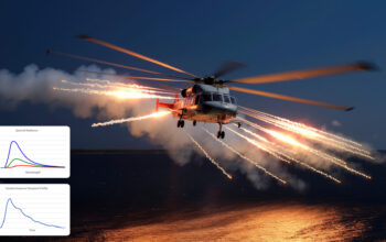
Aurizn developed a physics-based and validated Digital Flare Model for DSTG to enable simulated testing of scenarios to improve platform survivability.
'}}
Active Movement Extent Discrimination Apparatus: Technology Refresh
We ran a technology refresh to the Active Movement Extent Discrimination Apparatus, which is used by NASA to support research into astronaut rehabilitation strategies to counter long term effects of micro-gravity exposure.
'}}
Electro Optic Survivability Integration Laboratory (EOSIL)
We supported DSTG with a technical refresh of its turn-key high-precision test and evaluation capability for Threat Warning Systems to support more efficient survivability assessments.
'}}
Essential Energy – Vegetation Monitoring
By improving risk profiling of vegetation using remote geospatial sensing and AI, we helped power distributors improve electricity supply to millions across their network.
'}}
Cross Domain Desktop Compositor
Working closely with CSIRO, we developed a new cross domain desktop compositor to advance data security for Defence.
'}}
Tactile Cueing System
We accelerated the technology maturity of a Tactile Cueing System from TRL 3 to TRL 7, resulting in improved outcomes for pilots when hovering.
'}}
Electromagnetic Spectrum Synthetic Environment
We supported continuous evaluation of Electronic Warfare Self Protection (EWSP) systems and Tactics, Techniques and Procedures (TTPs) to improve effectiveness.
'}}
Tactics Development Experimentation
Through the AWAKENING Series of Experiments, Aurizn provided the ADF with insights into improving aircraft capabilities and platform survivability against land-borne ballistic weapons.